PROJECTS
Trinity County Community Wildfire Protection Plan (CWPP)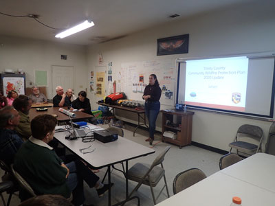
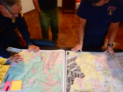
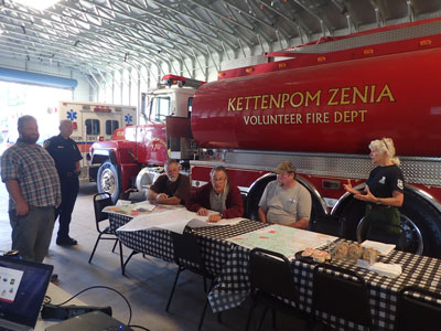
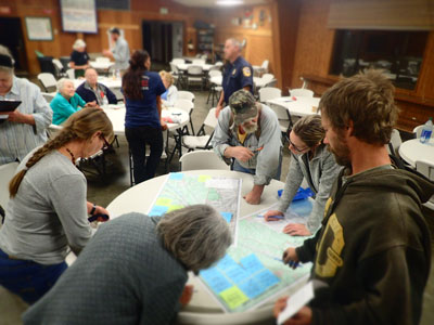
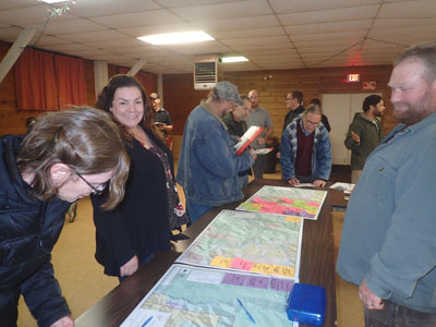
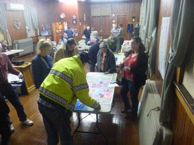
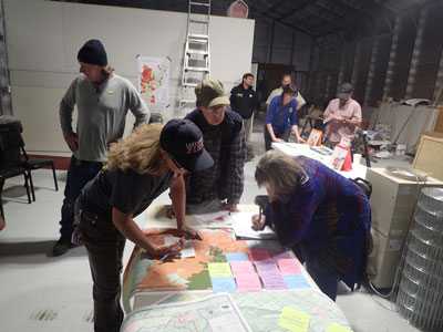
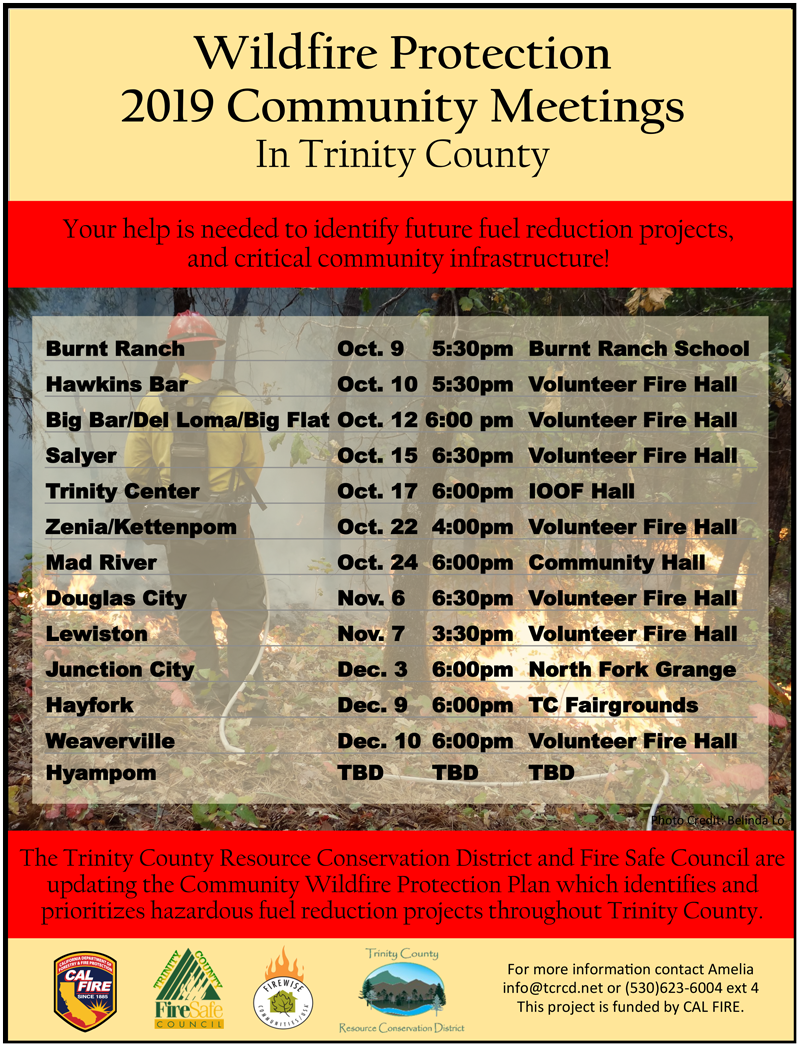
The Trinity County Community Wildfire Protection Plan (CWPP) is a countywide effort to help reduce the risk of catastrophic wildfire and protect communities and values at risk on a landscape scale. The Trinity County Fire Safe Council (FSC) was founded in 1998 and completed one of the first CWPPs in the US, which was finalized in 2005. Since then the Trinity County Resource Conservation District (TCRCD) has facilitated updating the CWPP in 2010 and 2015. TCRCD is currently working with the TCFSC on the 2020 update. The CWPP identifies and prioritizes fuel reduction projects in Trinity County. First, the projects are identified by community members and then prioritized by fire officials evaluating fire history, fuel loads, and fuel reduction project history. Next, the geographic information system (GIS) maps are created to display each project area identified for agencies to access and utilize for project development and implementation. Then the plan is written into one comprehensive document and reviewed by the public and agency officials. Finally the plan is approved by the Trinity County Fire Chiefs’ Association, Trinity County Board of Supervisors, and CAL FIRE. The projects that are identified in the CWPP are then utilized by organizations and agencies to apply for grant funds for fuel reduction projects. In the last 5 years TCRCD has raised $2.9 Million for fuel reduction work in Trinity County, including CWPP identified priority projects. The Watershed Research and Training Center brought in over $1 Million in the last year, and over the last 20 years the TCRCD has brought $8.5 Million to complete fuel reduction work in Trinity County. If you have questions about the 2020 CWPP Update Project, contact TCRCD Project Coordinator Amelia Fleitz at 530-623-6004 or afleitz@tcrcd.net . Trinity County CWPP 2020 Update2020 Trinity County CWPP Project Ranking DraftsBelow are the Trinity County CWPP Projects identified for the 2020 Update with the current draft prioritization as of 12/30/2020. These projects have been prioritized based on the methodology in the CWPP Analysis attachment. Past CWPP DocumentsCWPP Meeting PresentationsTrinity County Community Wildfire Protection Plan: 2020 Update
Trinity County Fire SimulationsHayfork Hay Fields Fire SimulationThis is a simulation of a fire that would start near the hay fields west of Hayfork with an westerly wind. The fire begins to spread radially through the grass fields and into the Tule Creek and Cedar Gulch Rd neighborhoods. The westerly wind pushes the fire east along both sides of HWY 3 through the fairgrounds, airport, and north into the Brady Rd neighborhood. On the west side of the fire, it continues to move west along Hyampom Road through the Doctor Lane neighborhood and on towards Forest Rd 31N50. Back to the east side of the fire, the fire has progressed through town and has a head that has crossed the 16 Rd (Big Creek Rd) with a spot fire ahead of the main fire in Barker Valley. The fire has continued to spread south through the Tule and Salt Creek drainages and into the Kingsbury Gulch. In the end much of the town has burned as a result of a catastrophic fire, again this is only a simulation. Today many organizations across Trinity County are collaborating to develop strategic fuel breaks, landscape thinning, and improve private defensible space to reduce the risk of catastrophic fires. These videos were produced by Tierra Fuego for the Trinity County Resource Conservation District and was funded by CAL FIRE. Weaverville Wetlands Fire SimulationThis is a simulation of a fire that would start near the industrial wetlands east of Weaverville with an easterly wind. The south head of the fire spreads towards Weaver Creek and spreads into the Timber Ridge Community. The western head of the fire spreads across HWY 3 towards Ponderosa Lane and Hall Way. As the easterly winds increase spot fires begin to jump north of the fire, spreading the fire into and through Weaverville. The fire now has a north western head which came from Timber Ridge and burned towards Oregon Street towards Trinco and finally across HWY 299. The fire on the east near Hall Way progresses north through the through Lance Gulch Road and spots out ahead to Lowden Park. A second head on this northeast side pushes towards Musser hill and on towards the CAL FIRE Station on HWY 3. At this time, the northwestern head of the fire has pushed up Oregon Mountain and is slowly spreading west towards the Hayfork Divide, it is also expanding east over Jackass Ridge towards the airport and down into the neighborhoods around Reservoir Rd. In the end much of the town has burned as a result of a catastrophic fire, again this is only a simulation. Today many organizations across Trinity County are collaborating to develop strategic fuel breaks, landscape thinning, and improve private defensible space to reduce the risk of catastrophic fires. These videos were produced by Tierra Fuego for the Trinity County Resource Conservation District and was funded by CAL FIRE. Hayfork Fire Simulation - Pre and Post Fuel TreatmentOpen Canopy Production produced this model of Hayfork based off the model produced last year for Hayfork, with a wildfire starting in the agricultural fields west of Hayfork. Then projects identified in the Trinity County Community Wildfire Protection Plan community meetings were added into the model. Projects include roadside shaded fuels breaks and defensible space work. Check out how the projects change the direction of spread and rate of spread of the wildfire. This model is does not take into account suppression efforts which also impact the progression of a wildfire. This is only a model and not to be taken as fact. This collaboration was made possible by the Fire Adapted Communities Learning Network. Weaverville Fire Simulation - Pre and Post Fuel TreatmentOpen Canopy Production produced this model based an escaped campfire. Then projects identified in the Trinity County Community Wildfire Protection Plan community meetings were added into the model, specifically shaded fuel breaks and defensible space. Check out how the projects change the direction of spread and rate of spread of the wildfire. This model is does not take into account suppression efforts which also impact the progression of a wildfire. This is only a model and not to be taken as fact. This collaboration was made possible by the Fire Adapted Communities Learning Network. Hawkins Bar Fire Simulation - Pre and Post Fuel TreatmentOpen Canopy Production produced this model based off a spark from State Route 299 starting a fire along the road. Then projects identified in the Trinity County Community Wildfire Protection Plan community meetings were added into the model. Check out how the projects change the direction of spread and rate of spread of the wildfire. This model is does not take into account suppression efforts which also impact the progression of a wildfire. This is only a model and not to be taken as fact. This collaboration was made possible by the Fire Adapted Communities Learning Network. Trinity Center Fire Simulation - Pre and Post Fuel TreatmentOpen Canopy Production produced this model based an escaped campfire. Then projects identified in the Trinity County Community Wildfire Protection Plan community meetings were added into the model, specifically shaded fuel breaks and defensible space. Check out how the projects change the direction of spread and rate of spread of the wildfire. This model is does not take into account suppression efforts which also impact the progression of a wildfire. This is only a model and not to be taken as fact. This collaboration was made possible by the Fire Adapted Communities Learning Network. Douglas City Fire Simulation - Pre and Post Fuel TreatmentOpen Canopy Production produced this model based an escaped campfire. Then projects identified in the Trinity County Community Wildfire Protection Plan community meetings were added into the model, specifically shaded fuel breaks and defensible space. Check out how the projects change the direction of spread and rate of spread of the wildfire. This model is does not take into account suppression efforts which also impact the progression of a wildfire. This is only a model and not to be taken as fact. This collaboration was made possible by the Fire Adapted Communities Learning Network. Big Bar Simulation - Pre and Post Fuel TreatmentOpen Canopy Production produced this model based a roadside ignition along Hwy 299. Then projects identified in the Trinity County Community Wildfire Protection Plan community meetings were added into the model, specifically shaded fuel breaks and defensible space. Check out how the projects change the direction of spread and rate of spread of the wildfire. This model is does not take into account suppression efforts which also impact the progression of a wildfire. This is only a model and not to be taken as fact. This collaboration was made possible by the Fire Adapted Communities Learning Network. Junction City Simulation - Pre and Post Fuel TreatmentOpen Canopy Production produced this model based a fire starting say around 6am (so down canyon winds) along Dutch Creek Rd near the Evans Bar River Access. Then projects identified in the Trinity County Community Wildfire Protection Plan community meetings were added into the model, specifically shaded fuel breaks and defensible space. Check out how the projects change the direction of spread and rate of spread of the wildfire. This model is does not take into account suppression efforts which also impact the progression of a wildfire. This is only a model and not to be taken as fact. This collaboration was made possible by the Fire Adapted Communities Learning Network. Lewiston Simulation - Pre and Post Fuel TreatmentOpen Canopy Production produced this model based on a roadside ignition on Trinity Dam Blvd. Then projects identified in the Trinity County Community Wildfire Protection Plan community meetings were added into the model, specifically shaded fuel breaks and defensible space. Check out how the projects change the direction of spread and rate of spread of the wildfire. This model is does not take into account suppression efforts which also impact the progression of a wildfire. This is only a model and not to be taken as fact. This collaboration was made possible by the Fire Adapted Communities Learning Network. Trinity Lake / Covington Mill Simulation - Pre and Post Fuel TreatmentOpen Canopy Production produced this model based on a roadside ignition on HWY 3. Then projects identified in the Trinity County Community Wildfire Protection Plan community meetings were added into the model, specifically shaded fuel breaks and defensible space. Check out how the projects change the direction of spread and rate of spread of the wildfire. This model is does not take into account suppression efforts which also impact the progression of a wildfire. This is only a model and not to be taken as fact. This collaboration was made possible by the Fire Adapted Communities Learning Network. Ruth Lake Simulation - Pre and Post Fuel TreatmentOpen Canopy Production produced this model based on a roadside ignition on Lower Mad River Road. Then projects identified in the Trinity County Community Wildfire Protection Plan community meetings were added into the model, specifically shaded fuel breaks and defensible space. Check out how the projects change the direction of spread and rate of spread of the wildfire. This model is does not take into account suppression efforts which also impact the progression of a wildfire. This is only a model and not to be taken as fact. This collaboration was made possible by the Fire Adapted Communities Learning Network.
Helpful links for Landowners from the CalFire Ready for Wildfire website 
Funded by CALFIRE |
CONTACT > Trinity County RCD, PO Box 1450, #30 Horseshoe Lane, Weaverville, CA 96093 |
| |